

Why the creek matters
Maxwell Creek was the reason Murphy exists. The first settlers, the McMillen and Maxwell families, arrived in 1846 and settled on a branch of what was then called Muddy Creek. The creek was renamed for James and Henry Maxwell, and for a time the settlement itself was called Maxwell's Creek and then Maxwell's Branch before becoming Murphy in 1888.
Today the creek is the main natural feature in a city that is otherwise almost fully developed. The 2026 Murphy Master Plan describes it as a defining asset that supports parks, trails, drainage, and wildlife habitat, and also as a physical edge that divides the city east and west. The trail system along it links several parks, and residents in the Master Plan's public meetings asked for more ways to cross it.
The trail at a glance
| Segment | Surface | Approximate length | Connects to |
|---|---|---|---|
| Waters Edge Park loop | Concrete | 0.25 miles | Linear trail |
| Linear trail from Waters Edge Park | Concrete | 1.66 miles | Preserve at Maxwell Creek, Central Park |
| North from Waters Edge Park | Concrete | About 1 mile | McMillen Road |
| South from Waters Edge Park | Concrete | About 1 mile | McCreary Road |
| Creekside natural trails | Natural surface | About 5 miles | Along Maxwell Creek |
| Preserve at Maxwell Creek | Granite | Not published | Creek footbridge |
| Central Park trail | 8-foot concrete | About 0.6 miles | Maxwell Creek Trail |
Lengths are from the City of Murphy's park pages. The city does not publish a single total for the full system.
Stop by stop
Waters Edge Park
601 Creekside Drive, in the Maxwell Creek North subdivision
This is the best starting point for the eastern side of the system. The 4.4-acre park was built in 2005 and renovated in 2020.
- Inclusive playground for ages 5 to 12 with poured-in-place rubber surfacing
- Three practice soccer fields (one large, two small)
- Shaded picnic area with four tables
- Quarter-mile walking loop
- Four ADA parking spaces near the playground and fields
From here, the concrete trail runs about a mile north toward McMillen Road and about a mile south toward McCreary Road, and the 1.66-mile linear trail heads toward the Preserve and Central Park. Tibbals Elementary is on the same street, at 621 Waters Edge Way.
The Preserve at Maxwell Creek
670 N. Murphy Road, behind Kimbrough Stadium
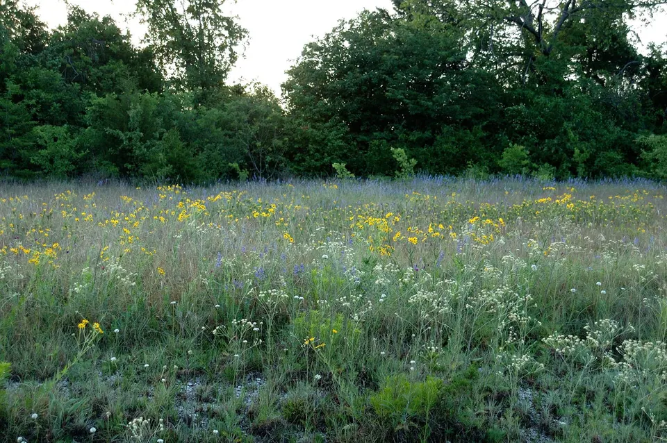
The Preserve is the most natural-feeling segment. A granite nature trail with interpretive kiosks leads to a long footbridge over the creek, and benches sit under shade trees. Facilities are simple: a pavilion with four picnic tables, a half-size basketball court, and a backstop. The pavilion and court can be reserved.
Murphy Central Park
550 N. Murphy Road
Central Park ties the trail to the city's civic center. Its roughly 0.6 miles of 8-foot concrete trail connect to the Maxwell Creek Trail. The park covers 52 acres, with a 2-acre stocked pond, an amphitheater that seats 2,500 to 3,000, multipurpose fields, a covered playground, restrooms, and a splash pad that runs daily from 9 a.m. to 8 p.m. from the Saturday before Memorial Day through Labor Day. This is also the site of Maize Days each October and the Murphy Family Campout each November.
Other trail access points
The city lists two additional neighborhood access points:
- Lonesome Dove, 1225 Lonesome Dove Drive, with a short section of concrete trail
- Cactus Path, 1112 Cactus Path Drive, which is undeveloped
Timbers Nature Preserve Park: the western link
Timbers Nature Preserve Park is not on Maxwell Creek, but it is the trail system's connection to neighboring cities. Its roughly 1 mile of 14-foot-wide hike and bike trail (10 feet of concrete and 4 feet of asphalt) connects to Plano's trail system and to Breckinridge Park in Richardson, and the city lists future connections to Wylie and Sachse as planned.
The park itself covers 28 acres: 12 acres of active park and 16 acres of nature preserve around a 1.25-acre pond. It has about 1.6 miles of paved trails, two pavilions with grills, covered playgrounds for ages 2 to 5 and 5 to 12, three baseball practice areas, basketball and tennis courts, a fire pit, restrooms, and fishing. It opened in 2000 as Murphy City Park and was renovated and expanded in 2015.
What is planned
The 2026 Master Plan treats trail connections as a priority. Community forum participants highlighted the planned bridge where Maxwell Creek meets FM 544, which would let trail users cross the busiest road in the city without walking along it. As of October 2026 that lighted bicycle and pedestrian bridge was still unbuilt. The city opened bids on April 30, 2026; all three, from $5.6 million to $6.5 million, were over budget and were ruled non-responsive to TxDOT requirements. The City Council voted in July to rebid, then on October 6, 2026 agreed to delay the rebid until it discusses the project again in 2027, while a contract to redesign the bridge appeared on the same meeting's consent agenda. The Master Plan's recommendations include more east-west crossings of the creek, sidepaths along Maxwell Creek north of FM 544, and connections to adjacent trail systems, including to the west along a rail line easement and to county-wide networks. The city also participated in a 2012 multi-jurisdictional effort to plan regional trail links.
Participants in the Master Plan's public meetings noted that FM 544 traffic makes walking and biking near the corridor uncomfortable, which is why the crossing and buffering projects rank high.
One rule to know before riding: city staff reminded residents in July 2026 that pedal-assisted e-bikes are allowed on trails and in parks, but battery-powered dirt bikes without pedals are not.
Practical notes
- Reservations: pavilions, courts, and athletic fields are reserved through Murphy Parks and Recreation at 972-468-4444.
- Surfaces: most connecting segments are concrete; the Preserve uses granite and the creekside trails are natural surface.
- Flooding: creek-level trails and low crossings can hold water after storms. Avoid flooded sections.
- Maps: the City of Murphy publishes an interactive parks system map with a park tour on its website.
Sources (12)
- City of Murphy: Waters Edge Park
- City of Murphy: Preserve at Maxwell Creek and trail locations
- City of Murphy: Murphy Central Park and Amphitheater
- City of Murphy: Timbers Nature Preserve Park
- City of Murphy: Parks System Map
- City of Murphy: History
- City of Murphy: 2026 Murphy Master Plan
- City of Murphy: Community Events
- Murphy Monitor: "Pedestrian bridge bids were over budget" (July 30, 2026)
- Murphy Monitor: "Murphy to discontinue Flock cameras" (October 6, 2026; bridge rebid delayed)
- Murphy Monitor: "Council considers public works, IT contracts" (October 8, 2026)
- Murphy Monitor: "Battery-powered dirt bikes not allowed in city parks" (July 16, 2026)
Last reviewed October 12, 2026. See something out of date? Email info@grisak.com.
 Schools
 Moving to Murphy
